Crack specialists brought in to solve Rothbury road problem
and live on Freeview channel 276
The historic problem on the B6344 at Todstead, between Weldon Bridge and Rothbury, arises from the complex combination of the underlying geology of the valley, the weak soils, water pressure within the underlying rocks and erosion by the River Coquet.
These issues are typical across large parts of the Coquet valley. The soils in the valley were laid down in glacial times and have been subject to movement ever since, causing the hillside to move downwards leading to cracking in the road.
Advertisement
Hide AdAdvertisement
Hide AdOn Boxing Day 2012, there was a landslip at nearby Crag End which closed the road for over three years and cost over £10m to repair, with drivers forced to take a four mile diversion through Longframlington.

At Todstead, there is evidence of movement and road repair to keep the road in use stretching back decades.
Detailed monitoring and investigation has been on-going for some time at Todstead and Northumberland County Council has carried out deep drainage works to reduce the water pressure, which has been successful in halting movement over a longer length of the slope.
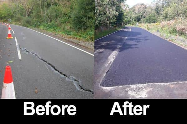
However, a smaller section of the hillside has continued to move and is continuing to cause cracking to the road surface. This is being repaired as necessary both to keep the surface safe for users but also to seal it and reduce water entering the ground beneath.
Advertisement
Hide AdAdvertisement
Hide Ad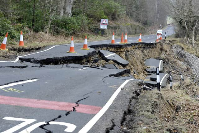
Now detailed analysis and investigation is continuing with international geotechnical design consultants Atkins to identify a long-term solution to this cracking.
Council leader Glen Sanderson said: “This area has been shifting slowly for thousands of years and we’re now looking at the very latest technology and specialist advice to try and sort it.
“The site is in a very difficult location close to the river and within the Coquet Valley Site of Special Scientific Interest so any works will need to be carefully planned so as not to unduly affect the environment or wildlife.
“Its close proximity to the River Coquet also means that any works will require an Environment Agency Permit, and any discharges to the river must be controlled.”
Advertisement
Hide AdAdvertisement
Hide Ad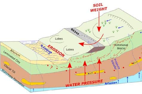
Preparations and the long-term solution are being carefully considered to ensure minimum disruption to users of the B6344. The council team is currently carrying out further analysis and modelling and is preparing for further detailed ground investigations to take place.
Detailed design work on possible solutions will start as soon as this ground investigation information is available and alongside input with specialist contractors it will help inform what could be built at this location.
Cllr Sanderson added: “Once the design work is completed we’ll have a full understanding of what options are available and a decision on how best to proceed will be made.
“In the meantime, through the use of monitoring equipment backed up with analysis and regular inspections, the site is continually kept under observation and the surfacing will continue to be repaired when required to keep the road open and safe for everyone who uses it.”